Home → Calgary Address → Douglasdale/Glen → 131 DOUGLASBANK CO SE
131 DOUGLASBANK CO SE, Calgary
131 DOUGLASBANK CO SE is a detached home built in 1990, located in Douglasdale/Glen, Calgary. Explore schools, daily and 15-minute accessibility, public transit, traffic safety, crime and disorder trends, nearby development, flood risk, fire protection, 311 service requests, tree canopy, housing history, assessment values, and property taxes.
Free interactive maps, detailed comparisons, and the latest available data.
🏫 School Accessibility & Capacity
This address has higher CBE utilization but stronger daycare capacity. Highest assigned-school utilization is 105%, while closest daycare records provide 221 licensed spaces.
🎓 School Performance
The matched PAT data shows a moderate grade-band difference for this address. Results range from 66.8 to 76.1. School rankings should be read as one indicator only, alongside school fit, program availability, transportation, learning supports, and family needs.
🚗 Daily Accessibility
LRT access is farther than the Calgary median for this address. Transit access is weaker here, based on the route to Canyon Meadows.
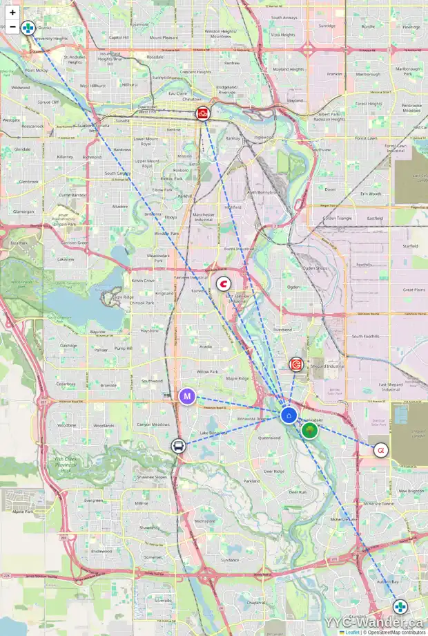
Click the map to explore the interactive version.
🧭 15-Minute Living Profile
Grocery access is a leading part of the available 15-Minute Living results for this address.
🚌 Nearby Bus Transit
Bus access at this address is mixed across stop proximity and nearby route availability.
👥 Community Profile
This address sits in a more settled community context, even though the children 0-4 share is below average.
🏘️ Community Density
Douglasdale/Glen has a population density of 2,005 people per km^2 and a residential density of 758 residential units per km^2. Compared with the Calgary community median, population density is 23.3% below and residential density is 29.5% below.
🌳 Nearby Tree Canopy Coverage
Canopy coverage at this address is 10.8 percentage points above the Douglasdale/Glen median and 14.2 percentage points above the Calgary median.
🌊 Flood Context & 🚒 Fire Protection Access
Flood mapping shows outside mapped flood zone. Emergency access is summarized by a 5.8 min drive to Douglas Glen Fire Station #39 and a hydrant distance of 47 m.
🚓 Crime Trends
The latest Crime Trends snapshot shows Douglasdale/Glen at 0.77 per 1,000 residents in 2026-06. That is 4.8% below the Calgary median, with violence-related incidents most common in the latest month.
📍 Disorder & Community Pressure
Latest-month reported disorder pressure in Douglasdale/Glen was similar to the Calgary median; common issue types included Suspicious Person, Suspicious Vehicle, and Disturbance.
🚦 Nearby Traffic Safety Incidents
Older traffic-safety records appear in the outer part of the 500-metre analysis area.
☎️ 311 Service Requests
Over the available 12-month window, Douglasdale/Glen averaged 16.44 311 requests per 1,000 residents. The 12-month comparison is 1.5% above the Calgary median, while the recent direction is rising.
🏗️ Nearby Development Permits
The closest matched Development Permit location is within 150 metres of this address, at about 107 m. A development permit does not confirm that work has started or will be completed.
🧱 Building Permit History
This page does not include usable Building Permit history for the address in the available City records.
🏚️ Housing History
Compared with the Douglasdale/Glen median, this address belongs to an older part of the local housing stock.
💰 Property Value & Tax History
Compared with similar homes in Douglasdale/Glen, this property is assessed 31.8% above. The comparison is based on 2026 assessment records.
See the Full Picture for 131 DOUGLASBANK CO SE
This page provides a quick overview of 131 DOUGLASBANK CO SE. For a complete interactive experience, open the YYC-Wander Address Explorer to explore maps, school details, flood context, fire access, assessment history, crime trends, community insights, and more.
Some interactive features and the latest available property information are only available in the YYC-Wander Address Explorer.
Free to explore.